THE STIRLING RANGE 
INCLUDES THE TOWNS 
CRANBROOK Cranbrook Tourist Bureau
Ganthorne St, Cranbrook WA
Telephone: (08) 9826 1008
Fax: (08) 9826 1090 Location 318 km's South of Perth on the Great Southern Highway.
(3k's from the junction of The Albany Hway and Great Southern Hway). 
Population Town approx: 350
Rural approx: 800
If you are travelling to the Great Southern Region and your interest is the Stirling Range, Cranbrook will make a wonderful base for your adventure as it is situated only 10km's away from these magnificent peaks in the Stirling Range National Park. The peaceful small rural town can provide you will sufficient services and accomodation.
Points Of Interest Sukey's Hill Lookout - Panoranmic views of the Stirling Range and Salt Lakes to the North and East. Gateway To The Stirlings - native gardens make a wonderful picnic and BBQ spot situated next to a huge wooden archway at Salt River Road. Lake Poorrarecup -A freshwater lake with white sandy beach. Swimming and Sailing a must. Fully facilitated.
GNOWANGERUP Location 345 km's South of Perth on the Gnowangerup to Jerramungup Rd. 
Population
Approx: 2000 The Gnowangerup Shire covers 5000 square km. The Shire is famous for its Mallee fowl a protected bird which builds large mounds, some over 5 metres wide and 1 metre tall, for nesting. Cropping takes up a large part of the Shire, crops include wheat , lupins, barley with canola, clover seed peas, oats and faba beans being additional crops. As well, Gnowangerup is also the heart of the stud Merino Sheep industry running in excess of 700,000 sheep.
Points Of Interest Telyarup Homestead - Lovely colonial homestead built in 1910. Historical Steam tractor situated in the main street, which was brought out from England in 1889. A natural permanent mineral spring supplies the local swimming pool and offers visitors a great picnic and rest area.
BORDEN Location South of Perth on Chester Pass Road.
 Borden named after an early Canadian Prime Minister is a small rural town serving visitors to the Stirling Ranges as well as the local community.
Points Of Interest
Wildlife Haven - situated near Borden is a small collection of kangaroos, emus, birds and donkeys. Down-under Plaque and Picnic Area.
ONGERUP Location Also situated on the Gnowangerup to Jerramungup Rd, 54 km's East of Gnowangerup.
Ongerup District Telecentre
Community based Telecommunications & Information
Technology Share Service

Ongerup is known for its action group for the preservation of the endangered Mallee Fowl.
Mallee Fowl Preservation Society
Ongerup Wildflower Display
Points Of Interest Ongerup and Needilup district museum residing in the old railway barracks, displaying history of the region. Town Garden, native plants are featured in the special area opposite the shops. Salt lakes - see the spectacular reflections in these magnificent lakes. Wildflower Festival Telecentre Cawalellup Reserve and Vaux Lake
TAMBELLUP Location Tambellup is 328 km south of Perth on the Great Southern Highway.

Tambellup Shire covers an area of 1,437sq kms. Katanning lies at the centre of the Region 44 km to the north providing a wide range of facilities and offers services to the region such as Dental, Medical, Financial, Retailing, and commercial services and community facilities. HISTORY OF TAMBELLUP Prior to European settlement Aboriginal People from the Kaneang tribe to the west and the Koreng tribe to the east inhabited the area. Tambellup's first settler was Mr Joseph Norrish, who had property east of today's townsite in 1872. The main street is named after Mr Norrish. In 1889 the Great Southern railway line opened and settlers began to arrive and the town was declared in 1898.
The name Tambellup is derived from a native word meaning 'Place of the Tamars'. Tamars are small marsupials that once flourished here. Some also believe it means 'place of thunder'.
CLIMATE Tambellup has hot, dry summers and crisp wet winters. Average day temperature ranges from about 30 degrees Celcius in January to about 14 degrees in July. Night-time temperatures range from approx 13 degrees to 5 degrees. Most of the rain falls during the months of May to August.
Points Of Interest Museum Golf Club Tambellup Craft Fair - Wagtail Crafts
 THE
LILY
CRANBROOK HOTEL
ST OSWALD'S CHURCH
GNOWANGERUP HOTEL
GORDON HALL
SHIRE HALL
TELYARUP HOMESTEAD STIRLING GATE CRAFTS ATTRACTIONS
STIRLING RANGE NATIONAL PARK
CLIMBING THE PEAKS:
Bluff Knoll (3 hours)
Toolbrunnup (2 and a half hours)
Mt Hassell (2 and a half hours) Mondurup (2 and a half hours)
Mt Magog (2 hours)
Talyuberup (2 and a half hours)
Yungermere (3 hours)
Ellen Peak (8 hours)
WILDFLOWERS
August to November GNOWANGERUP MINERAL SPRINGS
BIRDS AND ANIMALS
LAKES
MAILEUP DOWNS
collection of trees and shrubs
SUKEY'S HILL LOOKOUT
HISTORIC STEAM TRACTOR
Gnowangerup
EARLY AGRICULTURAL MACHINERY AND FARMING IMPLEMENTS
Gnowangerup showgrounds
ONGERUP AND NEEDILUP DISTRICT MUSEUM 
EVENTS
CRANBROOK WILDFLOWER DISPLAY
September-October
STIRLING RANGE AWARENESS ACTIVITIES
September and October
WAVE CAMP
Held by guiding clubs during July and September school holidays
MERINO FIELD DAYS
August/September, Gnowangerup
| YARDUP COTTAGE B&B
KARINYA ESTATE CRANBROOK CARAVAN PARK
STIRLING RANGE NATIONAL PARK CAMPSITE STIRLING RANGE CHALET & CARAVAN PARK
NATIONAL PARK MOIGNUP SPRINGS CAMP GROUND ONGERUP CARAVAN PARK HOLIDAY UNITS AND COTTAGES |
YARDUP COTTAGE CRANBROOK HOTEL
STIRLING GATE CAFE
BLUFF KNOLL CAFE
THE LILY CAFE
GNOWANGERUP HOTEL
GNOWANGERUP ROADHOUSE
AMELUP ROADHOUSE
ONGERUP ROADHOUSE
TAMBELLUP HOTEL
ONGERUP HOTEL MOTEL
BORDEN TAVERN/RESTAURANT GNOWANGERUP HOTEL
ONGERUP HOTEL MOTEL
TAMBELLUP HOTEL
CRANBROOK HOTEL 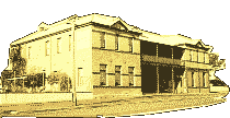
MAILEUP DOWNS FARMSTAY LOCAL TOUR GUIDES AND ENTERPRISE |
THE LILY
Guided tours through
Dutch windmill and workshop
STIRLING RANGE RETREAT guided bush walks
MAILEUP DOWNS FARM TOURS GILBERTS WINES
THE LILY |
STIRLING RANGES EMERGENCY SERVICES Gnowangerup Hospital: 9827 1003
Gnowangerup Ambulance: 9827 1003
Gnowangerup Police: 9827 1202
Gnowangerup Doctor: 9827 1005
Borden RAC: 9828 1046
Ongerup Police: 9828 2172 | Cranbrook Ambulance: 9826 1200
Cranbrook Police: 9826 1102
Cranbrook RAC: 9851 1755
Tambellup Police: 9825 1003
Tambellup Ambulance: 9825 1000 |
Brought to you by HostWA a division of JRC Internet Services
First Online Portal in the Great Southern Region
10/69 Lockyer Avenue - Albany - Western Australia - 6330
PH: 0438421822
| 